Provenance
Image credits
Each picture carries a badge saying what kind of image it is. So far there are 33 historical images, 0 adapted and 2 schematic models. Licenses were checked on the holding institution's own page, linked from each entry.
- Historical
- A real historical image, unaltered apart from cropping and resizing.
- Adapted
- A historical image we edited. The entry says what we changed.
- Schematic model
- Drawn in code from cited measurements, such as the 3D ears.
All images
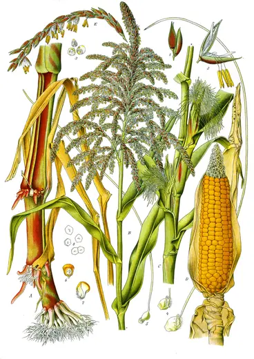 Historical
Zea Mays L., plate 78 in volume 3
- Shows
- Zea mays, with details of the male and female flowers and the grain
- Creator
- Köhler's Medizinal-Pflanzen (published by Franz Eugen Köhler, Gera)
- Date
- 1898
- Held by
- Missouri Botanical Garden, digitised for the Biodiversity Heritage Library; file from Wikimedia Commons
- License
- Public domain. The Biodiversity Heritage Library considers this work no longer under copyright protection.
- Changes
- Resized. The Commons copy we used already had its background whitened and its margins trimmed.
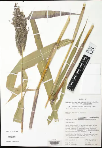 Historical
Isotype of Zea mays subsp. parviglumis, US National Herbarium sheet 3007398
- Shows
- Zea mays subsp. parviglumis (Balsas teosinte), a pressed specimen with tassel, leaves and stems
- Creator
- Specimen collected by Hugh H. Iltis and John F. Doebley; photographed by the Smithsonian Institution
- Date
- collected 22 September 1977
- Held by
- Smithsonian Institution, National Museum of Natural History, Department of Botany
- License
- CC0 1.0
- Changes
- Cropped to the sheet and resized.
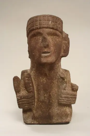 Historical
Maize Deity (Chicomecoatl)
- Shows
- A Mexica (Aztec) maize deity, Chicomecoatl, holding paired ears of maize
- Creator
- Mexica (Aztec) sculptor
- Date
- 15th–early 16th century
- Held by
- The Metropolitan Museum of Art, New York (accession 00.5.46)
- License
- CC0 1.0. Open Access, public domain.
- Changes
- Resized.
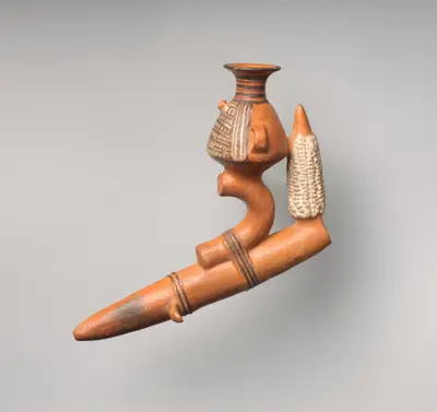 Historical
Paccha (ritual vessel)
- Shows
- An Inca ritual vessel (paccha) modeled with an ear of maize and a jar
- Creator
- Inca artist, Peru
- Date
- 1400–1535 CE
- Held by
- The Metropolitan Museum of Art, New York (accession 1986.383.1)
- License
- CC0 1.0. Open Access, public domain.
- Changes
- Resized.
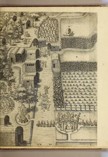 Historical
The Tovvne of Secota, plate XX in Thomas Hariot's A briefe and true report of the new found land of Virginia
- Shows
- The Algonquian town of Secotan, on the coast of what is now North Carolina, with maize fields at three stages of growth
- Creator
- Theodor de Bry, after a 1585 watercolor by John White
- Date
- 1590
- Held by
- John Carter Brown Library, Brown University
- License
- CC BY 4.0. Courtesy of the John Carter Brown Library.
- Changes
- Resized. This is an engraving made in Europe from White's painting, not the painting itself.
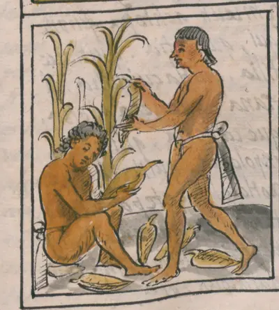 Historical
Florentine Codex (Historia general de las cosas de Nueva España), Book 4, folio 72r
- Shows
- Nahua farmers harvesting and husking maize
- Creator
- Nahua artists working with Bernardino de Sahagún
- Date
- about 1577
- Held by
- Biblioteca Medicea Laurenziana, Florence (Med. Palat. 218); scan from the Library of Congress, World Digital Library
- License
- Public domain. The Library of Congress is unaware of any copyright or other restrictions in the World Digital Library Collection.
- Changes
- Cropped to the lowest of three scenes on the page, and resized.
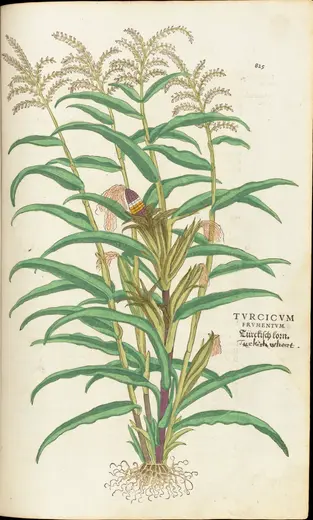 Historical
Turcicum frumentum, page 825 of De historia stirpium commentarii insignes
- Shows
- A whole maize plant, with one ear opened to show kernels of several colors
- Creator
- Leonhart Fuchs; drawn by Albrecht Meyer, copied to the block by Heinrich Füllmaurer, cut by Veit Rudolf Speckle
- Date
- 1542
- Held by
- Wellcome Collection, London
- License
- Public domain. Public Domain Mark. Source: Wellcome Collection.
- Changes
- Cropped to the page and resized. The coloring and the handwritten English note belong to this particular copy.
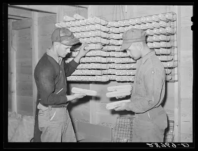 Historical
George and Hugh Clarke with hybrid seed corn. Grundy County, Iowa
- Shows
- Two Iowa farmers inspecting hybrid seed corn on drying racks
- Creator
- Arthur Rothstein, for the US Farm Security Administration
- Date
- October 1939
- Held by
- Library of Congress, Prints & Photographs Division, FSA/OWI Collection (LC-USF34-028769-D)
- License
- Public domain. No known restrictions on publication.
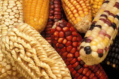 Historical
Maize from Latin America, Germplasm Enhancement of Maize project (image K7743-13)
- Shows
- Ears of maize from Latin America held in a US germplasm collection
- Creator
- Keith Weller, USDA Agricultural Research Service
- Date
- undated
- Held by
- USDA Agricultural Research Service, Image Gallery
- License
- Public domain. Photos in the ARS Image Gallery are copyright-free, public domain images unless otherwise indicated.
- Changes
- Resized. The collection records the ears only as coming from Latin America, without naming the varieties.
- Interactive 3D modelSchematic model
Schematic ears of teosinte, an early cob, a Mexican landrace and a modern hybrid, at one scale
- Method
- Drawn in code from the measurements cited beside each ear. Sizes are to scale; shapes, colors and anything marked as reconstructed are schematic.
- Based on
- Yang et al. 2019; Piperno & Flannery 2001; Benz 2001; Wellhausen et al. 1952; Tolley et al. 2021; Nielsen 2023
- Interactive 3D modelSchematic model
Models of the nine forms of Brassica oleracea, with versions of several (curly and Jersey kale, red and halved cabbage, purple kohlrabi, purple sprouting broccoli, orange, purple and Romanesco cauliflower), at one scale
- Method
- Built in Blender by a script (scripts/blender/brassica.py) that generates each leaf, head and flower from parameters, and drawn at the heights cited beside each form. Sizes are to scale; leaf counts, shapes, colors and anything marked as reconstructed are schematic.
- Based on
- Drenckhahn 2017; Vilmorin-Andrieux et Cie 1920; Jansen et al. 1993; van der Vossen 1993; van der Vossen 1993; Sagwansupyakorn 1993; Prendergast & Rumball 2000; Candolle 1824; Royal Horticultural Society 2026; Royal Horticultural Society 2026
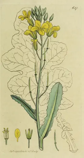 Historical
Brassica oleracea, Sea Cabbage, plate 637 of English Botany, volume 9
- Shows
- Wild Brassica oleracea in flower, titled "Sea Cabbage" in the accompanying text, drawn from a plant on the coast of south-west England
- Creator
- James Sowerby (drawing and engraving); text by James Edward Smith
- Date
- 1799
- Held by
- Wellcome Collection, London
- License
- Public domain. Public Domain Mark. Source: Wellcome Collection.
- Changes
- Cropped to the plate and resized. The plate is dated September 1, 1799. Its text says the plant grows "on cliffs by the sea-side" and that Sowerby drew this one at King's Cove.
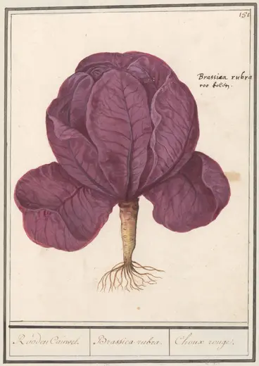 Historical
Red cabbage, from an album of flowers, object RP-T-BR-2017-1-9-56
- Shows
- A red cabbage plant, inscribed "Brassica rubra", "Rooden Cauwel" and "Choux rouge"
- Creator
- Anselmus Boëtius de Boodt (attributed) and Elias Verhulst
- Date
- 1596–1610
- Held by
- Rijksmuseum, Amsterdam
- License
- Public domain. Public Domain Mark 1.0, as shown on the museum's record for the object.
- Changes
- Cropped to the framed drawing and resized.
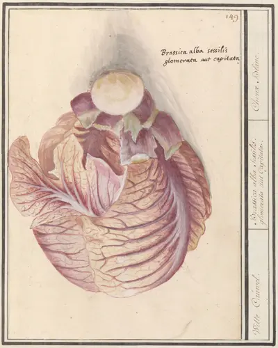 Historical
White cabbage, from an album of flowers, object RP-T-BR-2017-1-9-54
- Shows
- A head cabbage, inscribed "Brassica alba sessilis glomerata aut capitata", "Witte Cauwel" and "Choux blanc"
- Creator
- Elias Verhulst and Anselmus Boëtius de Boodt
- Date
- 1596–1610
- Held by
- Rijksmuseum, Amsterdam
- License
- Public domain. Public Domain Mark 1.0, as shown on the museum's record for the object.
- Changes
- Cropped to the framed drawing and resized. The drawing is some sixty years later than Fuchs's description of 1542.
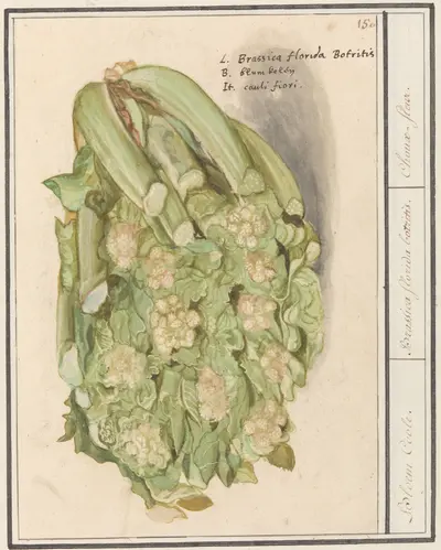 Historical
Cauliflower, from an album of flowers, object RP-T-BR-2017-1-9-55
- Shows
- A cauliflower, inscribed "Brassica florida Botritis", "Bloem Coole" and "Choux-fleur"
- Creator
- Anselmus Boëtius de Boodt and Elias Verhulst
- Date
- 1596–1610
- Held by
- Rijksmuseum, Amsterdam (on loan from a private collection)
- License
- Public domain. Copyright: Public domain (Public Domain Mark 1.0), as shown on the museum's page for the object.
- Changes
- Cropped to the framed drawing and resized.
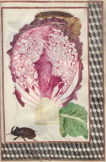 Historical
Cross Section of a Red Cabbage with a Beetle and Caterpillar with Geometric Border, folio 45 recto of a Florilegium (1963.594.45.a)
- Shows
- A red cabbage in cross section, with a beetle and a caterpillar
- Creator
- Unknown artist, France
- Date
- 1608
- Held by
- Cleveland Museum of Art
- License
- CC0 1.0. Open Access, CC0. "You can copy, modify, and distribute this work, all without asking permission."
- Changes
- Cropped to the page and resized.
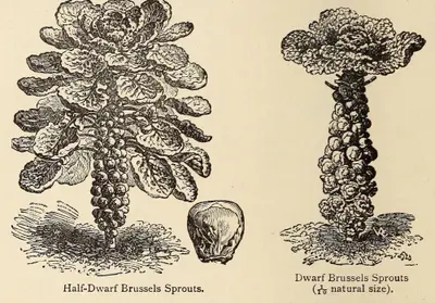 Historical
Half-Dwarf Brussels Sprouts and Dwarf Brussels Sprouts, page 156 of The Vegetable Garden, edited by William Robinson
- Shows
- Half-dwarf and dwarf Brussels sprouts, with a single sprout
- Creator
- Vilmorin-Andrieux et Cie; the engraver is not named
- Date
- 1920 (an edition of a work first published in English in 1885)
- Held by
- Library of Congress, Washington
- License
- Public domain. The books in this collection are in the public domain and are free to use and reuse.
- Changes
- Cropped to the two figures and their captions, and resized.
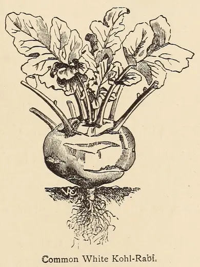 Historical
Common White Kohl-Rabi, page 165 of The Vegetable Garden, edited by William Robinson
- Shows
- Common White Kohlrabi
- Creator
- Vilmorin-Andrieux et Cie; the engraver is not named
- Date
- 1920 (an edition of a work first published in English in 1885)
- Held by
- Library of Congress, Washington
- License
- Public domain. The books in this collection are in the public domain and are free to use and reuse.
- Changes
- Cropped to the figure and its caption.
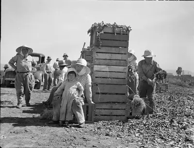 Historical
Japanese agricultural workers packing broccoli near Guadalupe, California
- Shows
- Japanese agricultural workers packing broccoli in a field near Guadalupe, California
- Creator
- Dorothea Lange, for the US Farm Security Administration
- Date
- 1937
- Held by
- Library of Congress, Prints & Photographs Division, FSA/OWI Collection (LC-USF34-016130-C)
- License
- Public domain. No known restrictions.
- Changes
- Cropped to remove the black edge of the negative.
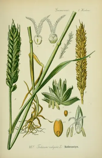 Historical
Triticum vulgare L., plate 46.I
- Shows
- Bread wheat, Triticum aestivum (labeled Triticum vulgare, Kolbenweizen, a beardless form), with details of the flowers and grain
- Creator
- Walter Müller (plates), for Otto Wilhelm Thomé's Flora von Deutschland, Österreich und der Schweiz (Gera)
- Date
- 1903 edition; the Flora first appeared in 1885
- Held by
- Biodiversity Heritage Library; file from the Wikimedia Commons copy of the library's own upload
- License
- Public domain. Marked Public Domain Work (Public Domain Mark 1.0) on the Biodiversity Heritage Library's photostream.
- Changes
- Resized.
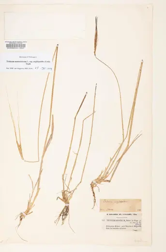 Historical
Triticum monococcum subsp. aegilopoides, specimen BM000086044
- Shows
- Wild einkorn, Triticum monococcum subsp. aegilopoides (collected as Triticum boeoticum), pressed plants with roots and ears
- Creator
- Collected by Benedict Balansa; photographed by the Natural History Museum, London
- Date
- collected 7 May 1854
- Held by
- Natural History Museum, London, Department of Botany
- License
- CC BY 4.0. The museum's Data Portal record gives the image license as CC BY 4.0, rights holder The Trustees of the Natural History Museum, London. (The scale bar in the photograph, which we cropped away, is printed "copyright reserved".)
- Changes
- Cropped to remove the scale bar and color chart.
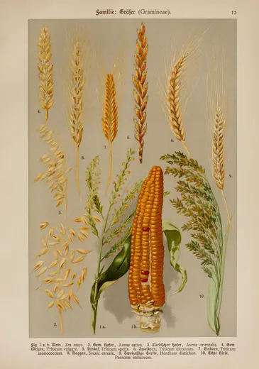 Historical
Familie Gräser (Gramineae), plate 17
- Shows
- Ears of bread wheat (4), spelt (5), emmer (6) and einkorn (7), with rye, two-rowed barley, oats, millet and maize
- Creator
- Hoffmann's Botanischer Bilderatlas, edited by E. Dennert (Stuttgart, Schweizerbart)
- Date
- 1911
- Held by
- Biodiversity Heritage Library; file from the Wikimedia Commons copy of the library's own upload
- License
- Public domain. Marked Public Domain Work (Public Domain Mark 1.0) on the Biodiversity Heritage Library's photostream.
- Changes
- Resized.
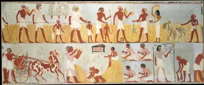 Historical
Harvest Scenes, Tomb of Menna
- Shows
- The measuring of a standing grain crop and the recording of the harvest, from the tomb of Menna at Thebes (Theban Tomb 69). The museum does not name the cereal.
- Creator
- Charles K. Wilkinson (painted copy), after the tomb painting
- Date
- original about 1396–1347 BCE; copy painted for the museum by 1930
- Held by
- The Metropolitan Museum of Art, New York (accession 30.4.44)
- License
- CC0 1.0. The museum's Open Access record marks the object as public domain; images so marked are released under CC0.
- Changes
- Cropped to remove a thin black border, and resized.
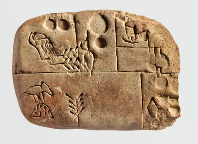 Historical
Cuneiform tablet: administrative account concerning the distribution of barley and emmer
- Shows
- A proto-cuneiform account of the distribution of barley and emmer, from southern Mesopotamia
- Creator
- Unknown scribe, southern Mesopotamia
- Date
- about 3100–2900 BCE
- Held by
- The Metropolitan Museum of Art, New York (accession 1988.433.2)
- License
- CC0 1.0. The museum's Open Access record marks the object as public domain; images so marked are released under CC0.
- Changes
- Cropped to the tablet and resized.
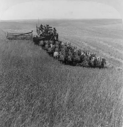 Historical
Evolution of sickle and flail – 33 horse team harvester, cutting, threshing and sacking wheat – Walla Walla, Washington
- Shows
- A horse-drawn combined harvester cutting, threshing and sacking wheat near Walla Walla, Washington
- Creator
- Underwood & Underwood (publisher; the photographer is not named)
- Date
- 1902
- Held by
- Library of Congress, Prints and Photographs Division (LC-USZ62-71468)
- License
- Public domain. No known restrictions on publication.
- Changes
- Cropped to one half of the stereograph, without its card mount and printed caption.
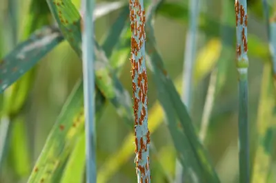 Historical
Close-up of stem rust on wheat (image K11192-1)
- Shows
- Stem rust, the fungus Puccinia graminis f. sp. tritici, on wheat stems
- Creator
- Yue Jin, USDA Agricultural Research Service
- Date
- published 2004
- Held by
- USDA Agricultural Research Service, Image Gallery
- License
- Public domain. Photographs in the ARS Image Gallery are copyright-free, public domain images unless otherwise indicated.
- Changes
- Resized.
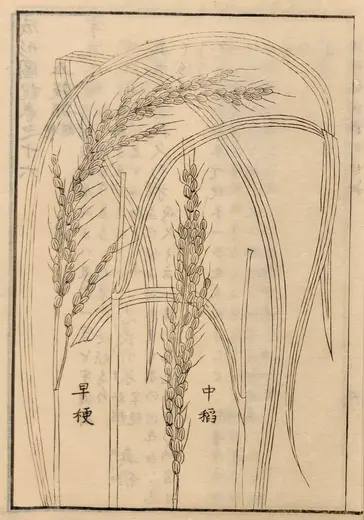 Historical
Rice, Ser. 1042, vol. 16, page 2, from the Seikei Zusetsu agricultural encyclopedia
- Shows
- Oryza sativa, two Japanese varieties, labeled 早稉 (an early-ripening rice) and 中稲 (a mid-season rice)
- Creator
- Unknown Japanese artist, for the Seikei Zusetsu
- Date
- 1793–about 1804
- Held by
- Leiden University Libraries (the copy given to Philipp Franz von Siebold)
- License
- Public domain. The rights status of this resource is public domain. Citing the Leiden University Libraries as a source is appreciated.
- Changes
- Cropped to the printed frame and resized.
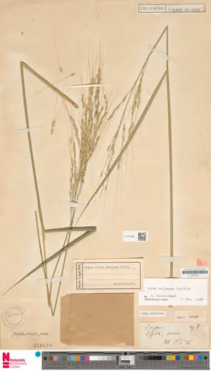 Historical
Herbarium specimen L.1277089, Oryza rufipogon Griff.
- Shows
- Oryza rufipogon, wild rice, a pressed specimen with an open, long-awned panicle. An older label on the sheet calls it Oryza fatua
- Creator
- Specimen collected by B. Balansa; photographed by Naturalis Biodiversity Center
- Date
- collected 31 October 1886
- Held by
- Naturalis Biodiversity Center, Leiden
- License
- CC0 1.0. Naturalis open data record for L.1277089: license CC0 1.0.
- Changes
- None.
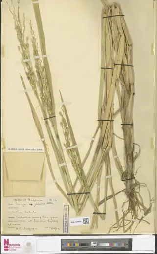 Historical
Herbarium specimen WAG.1242684, Oryza glaberrima Steud.
- Shows
- Oryza glaberrima, African rice, a cultivated plant with narrow panicles and awnless grains. The label says it is cultivated swamp rice from Sokoto, grown at Samaru
- Creator
- Specimen collected by H. C. Sampson; photographed by Naturalis Biodiversity Center
- Date
- collected 19 December 1929
- Held by
- Naturalis Biodiversity Center, Leiden (Wageningen herbarium, a duplicate from Kew)
- License
- CC0 1.0. Naturalis open data record for WAG.1242684: license CC0 1.0.
- Changes
- None.
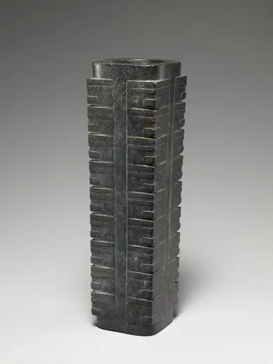 Historical
Ritual object (cong)
- Shows
- A jade cong, a ritual object of the Liangzhu culture of the lower Yangtze. It shows no rice
- Creator
- Liangzhu culture
- Date
- about 2400 BCE
- Held by
- The Metropolitan Museum of Art, New York (accession 2004.52)
- License
- CC0 1.0. Open Access. The museum's collection record marks the object as public domain.
- Changes
- Resized.
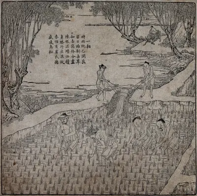 Historical
Rice cultivation: four men transplanting rice seedlings (?) in a paddy field, while behind them two men irrigate the field. Woodcut, 1696
- Shows
- Work in a flooded rice field, from the Kangxi emperor's printed Pictures of Tilling and Weaving. The museum catalogues it, with a query, as transplanting. The heading of the poem reads 一耘, the first weeding
- Creator
- Designed by Jiao Bingzhen for the Kangxi emperor
- Date
- 1696
- Held by
- Wellcome Collection, London (571282i)
- License
- Public domain. Public Domain Mark.
- Changes
- Resized.
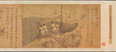 Historical
Rice Culture, or Sowing and Reaping (detail)
- Shows
- Raising water into a rice field with a treadle chain pump and a well sweep, from a Chinese handscroll of the farming year
- Creator
- Unidentified Chinese artist
- Date
- before 1353
- Held by
- The Metropolitan Museum of Art, New York (accession 2005.277)
- License
- CC0 1.0. Open Access. The museum's collection record marks the object as public domain.
- Changes
- None. This is the museum's own detail photograph.
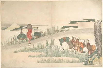 Historical
Spring in the Rice Fields
- Shows
- Transplanting rice seedlings in spring, Japan
- Creator
- Katsushika Hokusai
- Date
- about 1795
- Held by
- The Metropolitan Museum of Art, New York (accession JP2546)
- License
- CC0 1.0. Open Access. The museum's collection record marks the object as public domain.
- Changes
- Cropped to the print, leaving out the museum's color bar, and resized.
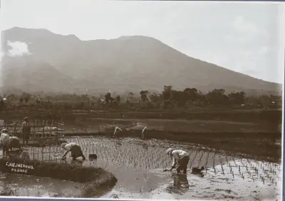 Historical
Indische boeren aan het werk op een rijstveld, op de achtergrond de bergen van Sumatra
- Shows
- Transplanting rice in flooded fields (sawah) in the Padang Highlands of Sumatra, below the volcano the album caption calls "de Merapi"
- Creator
- Christiaan Benjamin Nieuwenhuis
- Date
- about 1900–1920
- Held by
- Rijksmuseum, Amsterdam (RP-F-F01149-DA)
- License
- Public domain. Copyright: Public domain.
- Changes
- Cropped to the photograph, leaving out the album page and its handwritten caption, and resized.
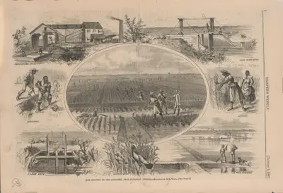 Historical
Rice culture on the Ogeechee, near Savannah, Georgia
- Shows
- Rice growing on the Ogeechee River near Savannah, Georgia, in January 1867: hoeing, ditching, reaping, flood gates and a threshing mill
- Creator
- Alfred R. Waud, for Harper's Weekly
- Date
- 5 January 1867
- Held by
- Library of Congress, Prints and Photographs Division (LC-DIG-ds-07365)
- License
- Public domain. No known restrictions on publication.
- Changes
- Cropped to the page and resized.
The base map
Coastlines, borders and rivers are from Natural Earth, which is in the public domain. The engraved look (water lines, hatching, paper and washes) is drawn by the site's own code and is not a historical map.